 vesseltracker.com
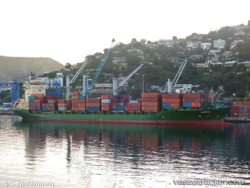
Vessel MSC EMILY II IMO: 9236444, MMSI: 636021412 Container Ship
UTC, 31.21533, 122.45204, course: 344, speed: 0.1
UTC, 31.21531, 122.45066, course: 7, speed: 0.3
2026-02-22 13:59:07 UTC, 31.21612, 122.44938, course: 38, speed: 0.1
Live AIS position:
UTC. Near Jingjiang),
updated 2026-02-22 13:59:07 UTC.
Find the position of the vessel MSC EMILY II on the map. The latter are known coordinates and path.
marine traffic ship tracker show on live map
The current position of vessel MSC EMILY II is 31.21612 lat / 122.44938 lng. Updated: 2026-02-22 13:59:07 UTCCurrently sailing under the flag of Liberia
MSC EMILY II built in 2003 year
Deadweight:
23063 tDetails:
Last coordinates of the vessel:
UTC, 31.21549, 122.45256, course: 335, speed: 0.4UTC, 31.21533, 122.45204, course: 344, speed: 0.1
UTC, 31.21531, 122.45066, course: 7, speed: 0.3
2026-02-22 13:59:07 UTC, 31.21612, 122.44938, course: 38, speed: 0.1